Natural Resources
Conservation Service
Ecological site R030XC017NV
LIMESTONE HILL 13+ P.Z.
Last updated: 2/25/2025
Accessed: 05/11/2025
General information
Provisional. A provisional ecological site description has undergone quality control and quality assurance review. It contains a working state and transition model and enough information to identify the ecological site.
Ecological site concept
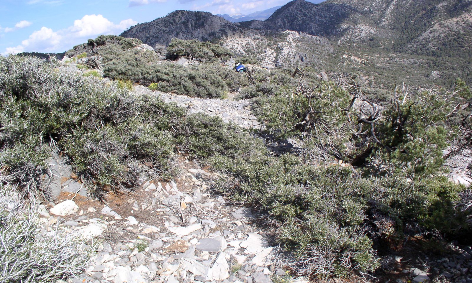
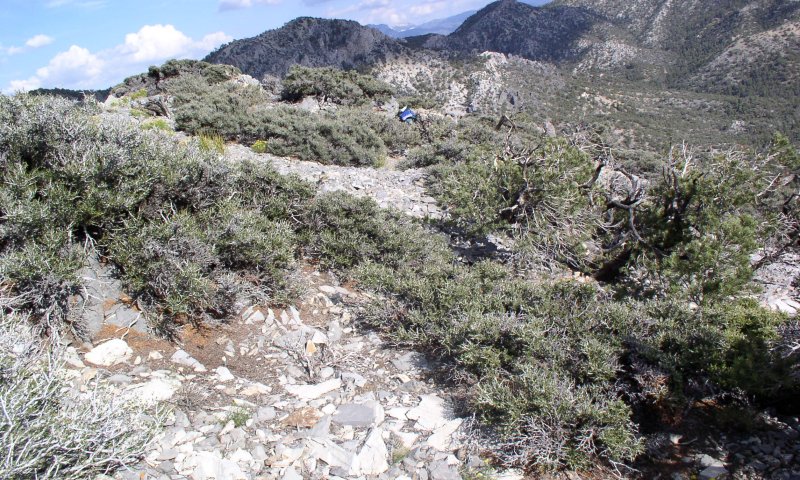
This site occurs on backslopes of mountains, ridges and rock outcrops. Slopes range from 30 to 75 percent. Elevations range from 6800 to 8200 feet. The soils associated with this site have formed in residuum and colluvium derived from limestone. These soils are typically very shallow to bedrock and well drained.
Please refer to group concept R030XC036NV to view the provisional STM.
Associated sites
| F030XC249NV |
Pinus monophylla/Quercus gambelii/Poa fendleriana |
|---|
Table 1. Dominant plant species
| Tree |
Not specified |
|---|---|
| Shrub |
(1) Cercocarpus intricatus |
| Herbaceous |
Not specified |
Physiographic features
This site occurs on backslopes of mountains, ridges and rock outcrops. Slopes range from 30 to 75 percent. Elevations range from 6800 to 8200 feet.
Table 2. Representative physiographic features
| Landforms |
(1)
Mountain
(2) Mountain slope (3) Ridge |
|---|---|
| Elevation | 6,800 – 8,200 ft |
| Slope | 30 – 75% |
| Aspect | E, S, W |
Climatic features
The primary air masses affecting the Spring Mountains are cold maritime polar air from the Gulf of Alaska and warmer, moist maritime subtropical air from lower latitudes. Occasionally there are invasions of cold continental polar air from northern Canada or the Rocky Mountains. Precipitation in the area results primarily from the passage of cyclones with associated fronts during fall, winter and spring; from closed cyclones in late winter and spring; and from the flow of moist tropical air from the southeast to the southwest quadrant in the summer.
The mean annual precipitation is 12 to 14 inches; mean annual air temperature is 45 to 50 degrees F, and the frost-free season is 90 to 130 days. There are no climate stations near this site.
Table 3. Representative climatic features
| Frost-free period (average) | 130 days |
|---|---|
| Freeze-free period (average) | |
| Precipitation total (average) | 14 in |
Influencing water features
There are no influencing water features associated with this site.
Soil features
The soils associated with this site have formed in residuum and colluvium derived from limestone. These soils are typically very shallow to bedrock and well drained. The soil profile is modified with high amounts of rock fragments. Runoff is very high. Available water holding capacity is very low. The soils usually have high amounts of gravels, cobbles or stones on the surface that occupy plant growth space, yet help to reduce evaporation and conserve soils moisture. The soil temperature regime is mesic and the soil moisture regime is ustic. Soil series associated with this site include Ednagrey.
Table 4. Representative soil features
| Surface texture |
(1) Extremely gravelly fine sandy loam |
|---|---|
| Family particle size |
(1) Loamy |
| Drainage class | Somewhat excessively drained |
| Permeability class | Moderately rapid |
| Soil depth | 4 – 10 in |
| Surface fragment cover <=3" | 50 – 70% |
| Surface fragment cover >3" | 5 – 10% |
| Available water capacity (0-40in) |
0.47 – 0.79 in |
| Calcium carbonate equivalent (0-40in) |
5 – 20% |
| Electrical conductivity (0-40in) |
Not specified |
| Sodium adsorption ratio (0-40in) |
Not specified |
| Soil reaction (1:1 water) (0-40in) |
7.9 – 8.4 |
| Subsurface fragment volume <=3" (Depth not specified) |
35 – 60% |
| Subsurface fragment volume >3" (Depth not specified) |
5 – 10% |
Ecological dynamics
Please refer to group concept R030XC036NV to view the provisional STM.
Fire effects:
The historic fire regime of littleleaf mountainmahogany communities probably varied with community type and structure. The estimated fire return interval is 50 to 75 years. Fires are very infrequent due to the sparseness of fine fuels. Trees such as pinyon and juniper may increase over time with lack of fire. Littleleaf mountainmahogany may depend on fire to reduce conifer competition and produce favorable soil conditions for seedling establishment. Littleleaf mountainmahogany decreases with heavy browsing by mule deer. Littleleaf mountainmahogany is moderately damaged by fire and there is very little sprouting following fire. Littleleaf mountainmahogany occurs on harsh sites that are rarely burned by fire. Mormon tea generally sprouts vigorously from the roots or woody root crown after fire and rapidly produces aboveground biomass from surviving meristematic tissue. Charleston Mountain goldenbrush is usually top-killed by fire. Oceanspray is top-killed by fire. Oceanspray is only moderately resistant to fire, but is well adapted to disturbance by fire. Oceanspray survives fire by regenerating from soil-stored seed or sprouting from surviving root crowns. Full recovery from a fire disturbance can be expected in 5 to 10 years. Indian ricegrass can be killed by fire, depending on severity and season of burn. Indian ricegrass reestablishes on burned sites through seed dispersed from adjacent unburned areas. Bottlebrush squirreltail's small size, coarse stems, and sparse leafy material aid in its tolerance of fire. Postfire regeneration occurs from surviving root crowns and from on- and off-site seed sources. Frequency of disturbance greatly influences postfire response of bottlebrush squirreltail. Undisturbed plants within a 6 to 9 year age class generally contain large amounts of dead material, increasing bottlebrush squirreltail's susceptibility to fire.
State and transition model
More interactive model formats are also available.
View Interactive Models
Click on state and transition labels to scroll to the respective text
Ecosystem states
State 1 submodel, plant communities
State 1
Reference Plant Community
Community 1.1
Reference Plant Community
The reference plant community is dominated by littleleaf mountain-mahogany. Common grasses include blue grama, Indian ricegrass, bottlebrush squirreltail and muttongrass. Common shrubs include Mormon tea, and Charleston Mountain goldenbush. Potential vegetative composition is approximately 10 percent grasses and grass-like plants, 5 percent forbs and 80 percent shrubs and up to 2 percent low stature trees. Approximate ground cover (basal and canopy) is 20 to 30 percent. Total annual air-dry production is 600 pounds favorable years, 450 pounds normal years, and 300 pounds on unfavorable years.
Figure 1. Annual production by plant type (representative values) or group (midpoint values)
Table 5. Annual production by plant type
| Plant type | Low (lb/acre) |
Representative value (lb/acre) |
High (lb/acre) |
|---|---|---|---|
| Shrub/Vine | 249 | 373 | 498 |
| Grass/Grasslike | 30 | 45 | 60 |
| Forb | 15 | 23 | 30 |
| Tree | 6 | 9 | 12 |
| Total | 300 | 450 | 600 |
Table 6. Ground cover
| Tree foliar cover | 0-5% |
|---|---|
| Shrub/vine/liana foliar cover | 20-30% |
| Grass/grasslike foliar cover | 1-5% |
| Forb foliar cover | 1-5% |
| Non-vascular plants | 0% |
| Biological crusts | 0% |
| Litter | 1-5% |
| Surface fragments >0.25" and <=3" | 50-70% |
| Surface fragments >3" | 1-5% |
| Bedrock | 1-10% |
| Water | 0% |
| Bare ground | 1-10% |
Table 7. Canopy structure (% cover)
| Height Above Ground (ft) | Tree | Shrub/Vine | Grass/ Grasslike |
Forb |
|---|---|---|---|---|
| <0.5 | 0-1% | 1-2% | 0-1% | 1-5% |
| >0.5 <= 1 | 0-5% | 1-5% | 1-5% | 1-5% |
| >1 <= 2 | 1-5% | 5-10% | 1-2% | 0-1% |
| >2 <= 4.5 | 1-5% | 10-20% | – | – |
| >4.5 <= 13 | 1-5% | – | – | – |
| >13 <= 40 | – | – | – | – |
| >40 <= 80 | – | – | – | – |
| >80 <= 120 | – | – | – | – |
| >120 | – | – | – | – |
Additional community tables
Table 8. Community 1.1 plant community composition
| Group | Common name | Symbol | Scientific name | Annual production (lb/acre) | Foliar cover (%) | |
|---|---|---|---|---|---|---|
|
Grass/Grasslike
|
||||||
| 1 | Primary Perennial Grasses | 18–46 | ||||
| Indian ricegrass | ACHY | Achnatherum hymenoides | 9–23 | – | ||
| squirreltail | ELEL5 | Elymus elymoides | 9–23 | – | ||
| 2 | Secondary Perennial Grasses | 1–14 | ||||
| threeawn | ARIST | Aristida | 2–5 | – | ||
| blue grama | BOGR2 | Bouteloua gracilis | 2–5 | – | ||
| muttongrass | POFE | Poa fendleriana | 2–5 | – | ||
|
Forb
|
||||||
| 3 | Perennial Forbs | 9–23 | ||||
| Indian paintbrush | CASTI2 | Castilleja | 2–5 | – | ||
| Jaeger's mousetail | IVJA | Ivesia jaegeri | 2–5 | – | ||
| phlox | PHLOX | Phlox | 2–5 | – | ||
|
Shrub/Vine
|
||||||
| 4 | Primary Shrubs | 252–384 | ||||
| littleleaf mountain mahogany | CEIN7 | Cercocarpus intricatus | 225–315 | – | ||
| mormon tea | EPVI | Ephedra viridis | 9–23 | – | ||
| Charleston Mountain goldenbush | ERCO40 | Ericameria compacta | 9–23 | – | ||
| oceanspray | HOLOD | Holodiscus | 9–23 | – | ||
| 5 | Secondary Shrubs | 1–23 | ||||
| Clokey's buckwheat | ERHEC | Eriogonum heermannii var. clokeyi | 5–14 | – | ||
| fivepetal cliffbush | JAAM | Jamesia americana | 5–14 | – | ||
| mat rockspirea | PECA12 | Petrophytum caespitosum | 5–14 | – | ||
| purple sage | SADOD2 | Salvia dorrii ssp. dorrii | 5–14 | – | ||
|
Tree
|
||||||
| 6 | Trees | 1–14 | ||||
| Utah juniper | JUOS | Juniperus osteosperma | 2–5 | – | ||
| Rocky Mountain juniper | JUSC2 | Juniperus scopulorum | 2–5 | – | ||
| singleleaf pinyon | PIMO | Pinus monophylla | 2–5 | – | ||
Interpretations
Animal community
Livestock Interpretations:
This site has limited value for livestock grazing, due to the low forage production and steep slopes. Grazing management should be keyed to perennial grasses or palatable shrubs production. Cattle and sheep will feed on littleleaf mountain mahogany slightly in the winter, and is generally of minor significance to livestock. Mormon tea is heavily browsed by livestock on winter range but only moderately or lightly browsed during other seasons. Charleston Mountain goldenbrush may be a source of browse for livestock, particularly in the late fall and early winter after more palatable species have been depleted. Oceanspray is generally unpalatable to the majority of livestock. Indian ricegrass is highly palatable to all classes of livestock in both green and cured condition. It supplies a source of green feed before most other native grasses have produced much new growth. Bottlebrush squirreltail is very palatable winter forage for domestic sheep of Intermountain ranges. Domestic sheep relish the green foliage. Overall, bottlebrush squirreltail is considered moderately palatable to livestock.
Stocking rates vary over time depending upon season of use, climate variations, site, and previous and current management goals. A safe starting stocking rate is an estimated stocking rate that is fine tuned by the client by adaptive management through the year and from year to year.
Wildlife Interpretations:
Littleleaf mountain mahogany is good winter browse for deer and elk. Mormon tea is an important browse species for big game animals. Mormon tea is heavily used by wildlife on winter ranges. Charleston Mountain goldenbrush may be a source of browse for wildlife, particularly in the late fall and early winter after more palatable species have been depleted. Oceanspray is generally unpalatable to the majority of big game. However, it comprised an average relative density of 10 percent of the summer diet of bighorn sheep populations. Plants are utilized by a variety of small bird species. Indian ricegrass is eaten by pronghorn in moderate amounts whenever available. A number of heteromyid rodents inhabiting desert rangelands show preference for seed of Indian ricegrass. Indian ricegrass is an important component of jackrabbit diets in spring and summer. Indian ricegrass seed provides food for many species of birds. Doves, for example, eat large amounts of shattered Indian ricegrass seed lying on the ground. Bottlebrush squirreltail is a dietary component of several wildlife species.
Hydrological functions
Rills – Few to none present due to high cover of rocks and gravels.
Water flow Patterns – Few to none.
Pedestals and/or Terracettes – No pedestalling. Terracettes found at bases of shrubs and large rocks.
Plant Community Composition and Distribution Relative to Infiltration and Runoff – High runoff common due to gravels and rocks. Plant community composition contributes little to infiltration.
Recreational uses
This site is used mainly for hiking.
Other information
There are four plant species of concern located in this ecological type within the Spring Mountains National Recreational Area (SMNRA). One species is endemic to the SMNRA. There are two mammal species of concern located within this ecological type.
Supporting information
Type locality
| Location 1: Clark County, NV | |
|---|---|
| Township/Range/Section | T18S. R54E. S3 NE |
| UTM zone | N |
| UTM northing | 4031161n |
| UTM easting | 0599098e |
| General legal description | Approximately 3 miles southeast of Mount Stirling, Spring Mountains, Clark County, Nevada. |
Other references
Clokey, Ira. 1951. Flora of the Charleston Mountains, Clark County, Nevada. University of California Press, Berkeley and Los Angeles.
Fire Effects Information System [Online]. http://www.fs.fed.us/feis.
Glenne, G., Johnson, D. 2002. Guide to Species of Concern in the Spring Mountains National Recreation Area, Clark and Nye Counties, Nevada. USFS, Las Vegas, NV.
Nachlinger, J., G. Reese. 1996. Plant Community Classification of the Spring Mountains National Recreation Area, Clark and Nye Counties, Nevada. The Nature Conservancy. Reno, Nevada. III. 14. Cercocarpus intricatus Series. Dwarf mountain mahogany Series. Pg. I-79-80.
Contributors
TJ WOLFE
Approval
Sarah Quistberg, 2/25/2025
Rangeland health reference sheet
Interpreting Indicators of Rangeland Health is a qualitative assessment protocol used to determine ecosystem condition based on benchmark characteristics described in the Reference Sheet. A suite of 17 (or more) indicators are typically considered in an assessment. The ecological site(s) representative of an assessment location must be known prior to applying the protocol and must be verified based on soils and climate. Current plant community cannot be used to identify the ecological site.
| Author(s)/participant(s) | TJ WOLFE |
|---|---|
| Contact for lead author | State Rangeland Management Specialist |
| Date | 06/22/2006 |
| Approved by | Sarah Quistberg |
| Approval date | |
| Composition (Indicators 10 and 12) based on | Annual Production |
Indicators
-
Number and extent of rills:
Few to none present due to high cover of rocks and gravels.
-
Presence of water flow patterns:
Few to none -
Number and height of erosional pedestals or terracettes:
No pedestalling. Terracettes found at bases of shrubs and large rocks.
-
Bare ground from Ecological Site Description or other studies (rock, litter, lichen, moss, plant canopy are not bare ground):
1 to 10 percent
-
Number of gullies and erosion associated with gullies:
None present -
Extent of wind scoured, blowouts and/or depositional areas:
No wind-scoured or blow out areas. Depositional areas found up slope of large shrubs and rocks. -
Amount of litter movement (describe size and distance expected to travel):
Litter, 2 inches or less may move with runoff.
-
Soil surface (top few mm) resistance to erosion (stability values are averages - most sites will show a range of values):
Soil surface very resistant due to high amounts of rocks and gravels. -
Soil surface structure and SOM content (include type of structure and A-horizon color and thickness):
Little to none due to high amounts of rock and gravels. Low amount of organic matter in soils -
Effect of community phase composition (relative proportion of different functional groups) and spatial distribution on infiltration and runoff:
High runoff common due to gravels and rocks. Plant community composition contributes little to infiltration.
-
Presence and thickness of compaction layer (usually none; describe soil profile features which may be mistaken for compaction on this site):
None
-
Functional/Structural Groups (list in order of descending dominance by above-ground annual-production or live foliar cover using symbols: >>, >, = to indicate much greater than, greater than, and equal to):
Dominant:
Sub-dominant:
Other:
Additional:
-
Amount of plant mortality and decadence (include which functional groups are expected to show mortality or decadence):
-
Average percent litter cover (%) and depth ( in):
-
Expected annual annual-production (this is TOTAL above-ground annual-production, not just forage annual-production):
-
Potential invasive (including noxious) species (native and non-native). List species which BOTH characterize degraded states and have the potential to become a dominant or co-dominant species on the ecological site if their future establishment and growth is not actively controlled by management interventions. Species that become dominant for only one to several years (e.g., short-term response to drought or wildfire) are not invasive plants. Note that unlike other indicators, we are describing what is NOT expected in the reference state for the ecological site:
-
Perennial plant reproductive capability:
Print Options
Sections
Font
Other
The Ecosystem Dynamics Interpretive Tool is an information system framework developed by the USDA-ARS Jornada Experimental Range, USDA Natural Resources Conservation Service, and New Mexico State University.
Click on box and path labels to scroll to the respective text.