Natural Resources
Conservation Service
Ecological site R040XD025CA
Sandsheet [2-4" p.z.]
Last updated: 3/04/2025
Accessed: 05/11/2025
General information
Provisional. A provisional ecological site description has undergone quality control and quality assurance review. It contains a working state and transition model and enough information to identify the ecological site.
MLRA notes
Major Land Resource Area (MLRA): 040X–Sonoran Basin and Range
Major land resource area (MLRA) 31 is the Lower Colorado Desert. This area is in the extreme southeastern part of California, in areas along the Colorado River, and in Western Arizona. The area is comprised of rough, barren, steep, and strongly dissected mountain ranges, generally northwest to southwest trending that are separated by intermontane basins. Elevation ranges from approximately 275 feet below sea level at the lowest point in the Salton Trough to 2700 feet along low northwest to southeast trending mountain ranges. The average annual precipitation is 2 to 6 inches with high temporal and spatial variability. Winter temperatures are mild, summer temperatures are hot, and seasonal and diurnal temperature fluctuations are large. Monthly minimum temperature averages range from 40 to 80 degrees F (4 to 27 degrees C). Monthly maximum temperature averages range from 65 to 110 degrees F (18 to 43 degrees C) (WRCC 2002). Temperatures are rarely below 28 degrees F, and extremely rarely fall below 24 degrees F. Precipitation is bimodal, with approximately 20 to 40 percent of annual precipitation falling between July and September. This summer rainfall, in combination with very hot temperatures and very few to no days of hard freeze are what characterize this MLRA and distinguish it from the Mojave Desert (MLRA 30).
Classification relationships
Mojave Creosote Bush (Holland, 1986).
Larrea tridentata Shrubland Alliance (Sawyer et al. 2009).
Ecological site concept
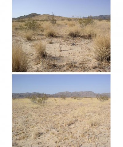
This site is above the playa landscape but often adjacent to the playa where dunes often fade into sandsheets. These very deep sands allow moisture to percolate deep and quickly and often limit shallow rooted plants from surviving at this site. Deep rooted plants like creosote can take advantage of this site and are often larger than ones on surrounding landforms but remain spaced far from each other. Although the deep sands mean water infiltrates deeper than sites with a finer textured surface, the sand does allow more moisture to infiltrate with very little run off, allowing annual plant species to take advantage of this site and thrive when ideal growing conditions exist. This site is far enough from the playa that periodic ponding does not happen, excluding plant species commonly associated with the playa landscape and its dune landforms.
Table 1. Dominant plant species
| Tree |
Not specified |
|---|---|
| Shrub |
(1) Larrea tridentata |
| Herbaceous |
(1) Pleuraphis rigida |
Click on box and path labels to scroll to the respective text.