Subalpine Slope

Scenario model
Current ecosystem state
Select a state
Management practices/drivers
Select a transition or restoration pathway
-
Transition T1A
Soil Degradation / Erosion
More details -
Restoration pathway R2A
Habitat protection, Seedbank Establishment
More details -
No transition or restoration pathway between the selected states has been described
Target ecosystem state
Select a state
Description
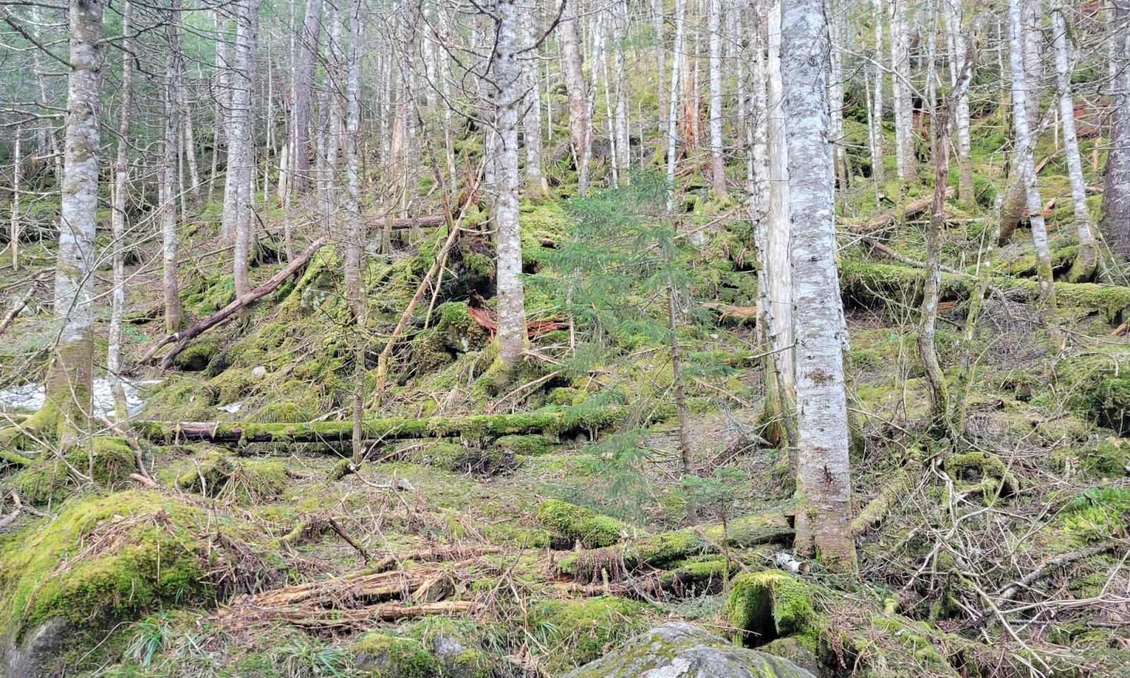
These are forests dominated by balsam fir, with common associates of red spruce, black spruce, and heartleaf paper birch in lower amounts. These communities are often seen as the first community types when transitioning into the alpine zone between 2500 and 4000 feet (762 and 1219 meters) in elevation, with a noticeable shift from the Northern Hardwood Forest complexes lower in elevation. These community types all correlate to the International Vegetation Classification (IVC) Hierarchy Alliance A443 “High Montane Red Spruce – Fir – Yellow Birch Forest” and LandFire’s CES201.566 “Acadian-Appalachian Montane Spruce-Fir Forest” classifications.
Submodel
States 1, 5 and 2 (additional transitions)
1.1. High Montane Balsam Fir – Birch Forest
1.5. High Montane (Mixed) Hardwood Forest
1.2. High Montane Red Spruce – Fir Forest
Description
This state consists of exposed areas within alpine communities in which the native vegetation is absent, displaced, or destroyed by soil degradation and erosion and will lack dominant vegetation cover.
Submodel
Mechanism
Soil degradation and erosion may lead to loss of habitat, resulting exposed soil or bedrock. This often occurs in localized zones of trampled vegetation, soil erosion, and unofficial trail development. Extreme loss of soils materials may create localized channels which can funnel snowmelt and increase habitat loss. Extreme loss may be more common on steeper, more slide-prone areas. Other factors such as historical high elevation logging, development (ski areas, wind generators, etc.), or historical fires may have similar or compounding effects.
Model keys
Briefcase
Add ecological sites and Major Land Resource Areas to your briefcase by clicking on the briefcase (![]() ) icon wherever it occurs. Drag and drop items to reorder. Cookies are used to store briefcase items between browsing sessions. Because of this, the number of items that can be added to your briefcase is limited, and briefcase items added on one device and browser cannot be accessed from another device or browser. Users who do not wish to place cookies on their devices should not use the briefcase tool. Briefcase cookies serve no other purpose than described here and are deleted whenever browsing history is cleared.
) icon wherever it occurs. Drag and drop items to reorder. Cookies are used to store briefcase items between browsing sessions. Because of this, the number of items that can be added to your briefcase is limited, and briefcase items added on one device and browser cannot be accessed from another device or browser. Users who do not wish to place cookies on their devices should not use the briefcase tool. Briefcase cookies serve no other purpose than described here and are deleted whenever browsing history is cleared.
Ecological sites
Major Land Resource Areas
The Ecosystem Dynamics Interpretive Tool is an information system framework developed by the USDA-ARS Jornada Experimental Range, USDA Natural Resources Conservation Service, and New Mexico State University.