
Subtropical Keys Tidal Rock Barrens of Southern Coast and Islands
Scenario model
Current ecosystem state
Select a state
Management practices/drivers
Select a transition or restoration pathway
-
Transition T1A
Human Alteration / Transportation of Materials
More details -
Transition T1B
Increase in Long-Term Hydroperiod
More details -
Transition T2A
Increase in Long-Term Hydroperiod
More details -
No transition or restoration pathway between the selected states has been described
Target ecosystem state
Select a state
Description
Keys tidal rock barren is a flat rockland with exposed limestone in supratidal zone. They are dominated by salt tolerant species along low-energy coastlines, typically found in the supratidal zones, with little to no soil development. it is inundated by salt water only during extreme high tides or storm surges.
Characteristics and indicators
This site is characterized by herbaceous and woody halophytic vascular plants. They occur on white colored limestone, in contrast to grey or black colored limestone of lower tidal zones.
Submodel
Description
These areas include soils that were intentionally and substantially modified by humans for an intended purpose, commonly for terraced agriculture, building support, mining, transportation, and commerce. The alteration is of sufficient magnitude to result in the introduction of a new parent material (human-transported material) or a profound change in the previously existing parent material (human-altered material). They do not include soils modified through standard agricultural practices or formed soils with unintended wind and water erosion. When a soil is on or above an anthropogenic landform or microfeature, it can be definitely be associated with human activity and is assigned to a unique taxa, usually found as an "Urban land complex" within that communities' natural soil properties (e.g., Rock outcrop-Cudjoe complex, tidal-Urban land complex, 0-1% slopes).
Characteristics and indicators
Evidence of these areas include soils with manufactured items (e.g. artifacts) present in the profile, human altered-materials (e.g., deeply excavated or deeply plowed soil) or human-transported material (e.g., fill), and position on or above anthropogenic landforms (e.g., flood-control levees) and microfeatures (e.g., drainage ditches). Detailed criteria regarding the identification of anthropogenic (artificial) landforms, human-altered materials, and human-transported material are in the "Keys to Soil Taxonomy" (Soil Survey Staff, 2014).
Submodel
Description
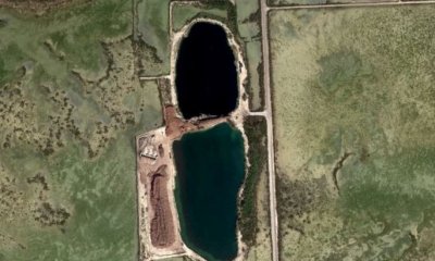
This state describes the impact of increased hydroperiods from anthropogenic or natural causes that creates an altered hydrologic state resulting in permanent flooding. The impact of this causes destruction of the terrestrial community and may in time shift to a subaqueous community.
Characteristics and indicators
This state is characterized by permanent water levels in an area that was previously in an intertidal or supratidal zone.
Resilience management
This is a final state and unlikely and improbable to go back to the original reference state.
Submodel
Mechanism
This transition is driven by the alteration and/ or transportation of materials via anthropogenic means.
Mechanism
This is driven by increased hydroperiods, both anthropogenic and natural, which causes long-term flooding and permanently altering the state.
Model keys
Briefcase
Add ecological sites and Major Land Resource Areas to your briefcase by clicking on the briefcase (![]() ) icon wherever it occurs. Drag and drop items to reorder. Cookies are used to store briefcase items between browsing sessions. Because of this, the number of items that can be added to your briefcase is limited, and briefcase items added on one device and browser cannot be accessed from another device or browser. Users who do not wish to place cookies on their devices should not use the briefcase tool. Briefcase cookies serve no other purpose than described here and are deleted whenever browsing history is cleared.
) icon wherever it occurs. Drag and drop items to reorder. Cookies are used to store briefcase items between browsing sessions. Because of this, the number of items that can be added to your briefcase is limited, and briefcase items added on one device and browser cannot be accessed from another device or browser. Users who do not wish to place cookies on their devices should not use the briefcase tool. Briefcase cookies serve no other purpose than described here and are deleted whenever browsing history is cleared.
Ecological sites
Major Land Resource Areas
The Ecosystem Dynamics Interpretive Tool is an information system framework developed by the USDA-ARS Jornada Experimental Range, USDA Natural Resources Conservation Service, and New Mexico State University.