Marshes

Scenario model
Current ecosystem state
Select a state
Management practices/drivers
Select a transition or restoration pathway
- Transition T1 More details
- Restoration pathway R1 More details
- Transition T2 More details
- Restoration pathway R2 More details
-
No transition or restoration pathway between the selected states has been described
Target ecosystem state
Select a state
Description
The dynamics described below are general to the level that the site concept has been developed for Provisional ES concept identification and further investigation purposes only. It is meant to give a general overview of the ecological dynamics of the system and should not be viewed as a model for a specific ecological site level management. It is supported by the current available literature that was reviewed for a general understanding of the system and basic understanding of the abiotic and biotic drivers. Further investigations and soil-site data collection and analysis should be conducted before specific land management can be applied at the ecological site specific scale. This STM only serves to explain the general ecology and dynamics.
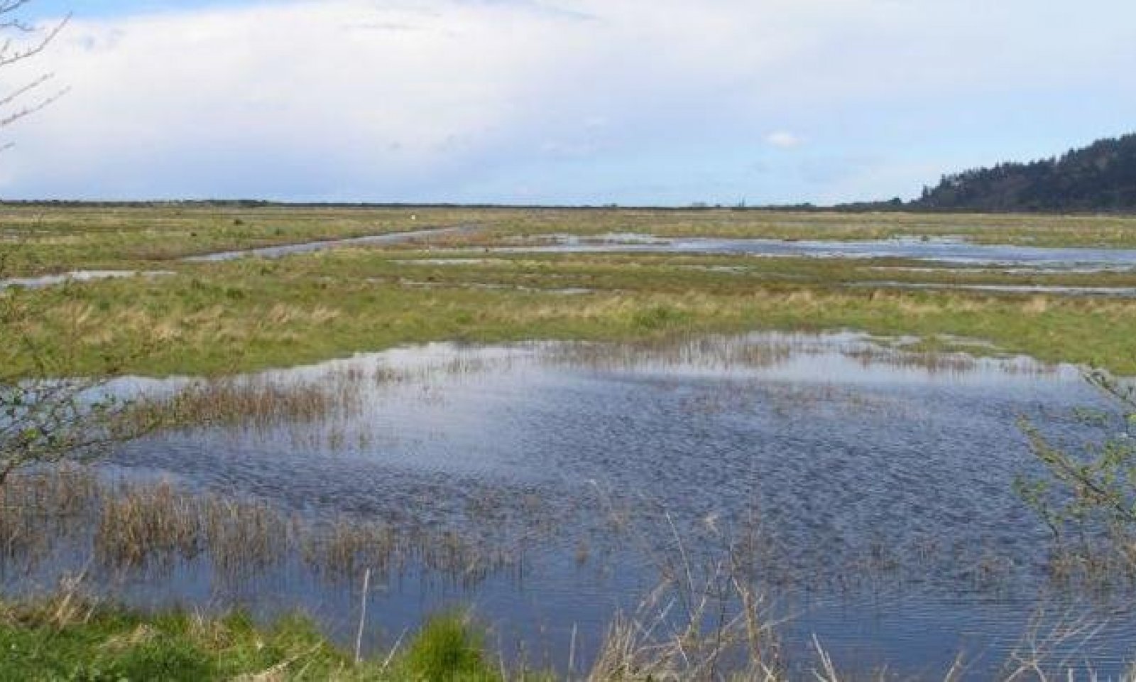
Reference State (State 1) – the reference state for this ecological site is a complex of vegetation expressions based on proximity to the coast line, salinity levels, and frequency and duration of tidal flooding. The complex interactions between the three factors, plus interspecific and intraspecific competition between plants dictates the cover and distribution of species within this salt marsh concept. This reference state is best represented in the Humbolt Bay in LRU A of MLRA 4B, however this site concept can be found all along the coast line of LRU A. Due to significant alterations by humans, a very small part of this ecological site is still in the reference state. At this very general scale, this reference state only really captures the generalities related to the functional groups that are most dominant and does not capture the more specific dynamics and patterns that would be found at the more detailed and refined ecological site scale that focuses on specific abiotic factors that drive some of these various complex plant expressions. More data and refinement is needed to capture the information needed in order to make specific land management decisions at the ecological site-component scale.
Submodel
Description
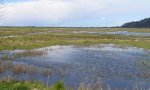
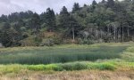
This state is represented by a less dynamic marsh that no longer experiences the typical flooding events of an open inlet marsh due to permanent closure of the inlet. This shifts the dynamics to either seasonal high water flooding that may be higher in freshwater sources from the upper watersheds in high rain events or man-made water inputs or from daily high tide flooding that overtops the impoundment barrier. This type of dynamic reduces the complexity of species types and distributions and shifts the sedimentation deposition and recharge of salt water. This can create scenarios that are more freshwater dominated as described above due to the inputs from the surrounding watershed or from the precipitation or it can create a scenario where the evapotranspiration rates during the warm, drier parts of the year shift the dominance more towards a more uniform distribution of higher salinity tolerant halophytes.
Submodel
Description
This state is represented by communities that result from the changing primary water source from the salt waters of the ocean to the more freshwater sources from rainwaters and groundwater/surface water discharge and runoff. The changes have occurred to such an extent that the water chemistry and dynamics are more representative of the brackish-freshwater marshes.
Submodel
Mechanism
This transition occurs through either the natural event of permanent impoundment of the salt marsh through an extremely large sedimentation event that closes off the marsh from the constant flooding events and limits flood impacts to high water events only (creating a backswamp scenario) or through human interventions that result in a similar scenario of cutting the marshes off from their inlet flooding source.
Mechanism
This pathway can occur by reconnecting the marsh with the natural flooding dynamics of the reference state. Especially in the case of naturally occurring sedimentation events that permanently closed off the inlet/outlet of the marsh. Once the sediment has been removed the site should return to its reference conditions fairly quickly. This type of management decision may be costly and may require maintenance if the sedimentation source remains.
Mechanism
This transition occurs mostly from continued man-made impacts that significantly alter the hydrology of this ecological site, through impoundments, increasing freshwater inputs from agriculture or urban developments, and increased sedimentation events.
Mechanism
This pathway may be possible and is entirely determined upon the potential to return some of the original hydrology back to the site. If the freshwater inputs are from man-made sources in the form of irrigation water, surface runoff, etc. finding solutions to limit/reduce these inputs will improve the salinity levels of the site and may shift it more towards State 2 bringing back some of the salt marsh species that are common in higher saline waters. It may be difficult in some cases however, to return the flooding impacts, depending on how the hydrology was disconnected from the site originally.
Model keys
Briefcase
Add ecological site groups and Major Land Resource Areas to your briefcase by clicking on the briefcase (![]() ) icon wherever it occurs. Drag and drop items to reorder. Cookies are used to store briefcase items between browsing sessions. Because of this, the number of items that can be added to your briefcase is limited, and briefcase items added on one device and browser cannot be accessed from another device or browser. Users who do not wish to place cookies on their devices should not use the briefcase tool. Briefcase cookies serve no other purpose than described here and are deleted whenever browsing history is cleared.
) icon wherever it occurs. Drag and drop items to reorder. Cookies are used to store briefcase items between browsing sessions. Because of this, the number of items that can be added to your briefcase is limited, and briefcase items added on one device and browser cannot be accessed from another device or browser. Users who do not wish to place cookies on their devices should not use the briefcase tool. Briefcase cookies serve no other purpose than described here and are deleted whenever browsing history is cleared.
Ecological site groups
Major Land Resource Areas
The Ecosystem Dynamics Interpretive Tool is an information system framework developed by the USDA-ARS Jornada Experimental Range, USDA Natural Resources Conservation Service, and New Mexico State University.