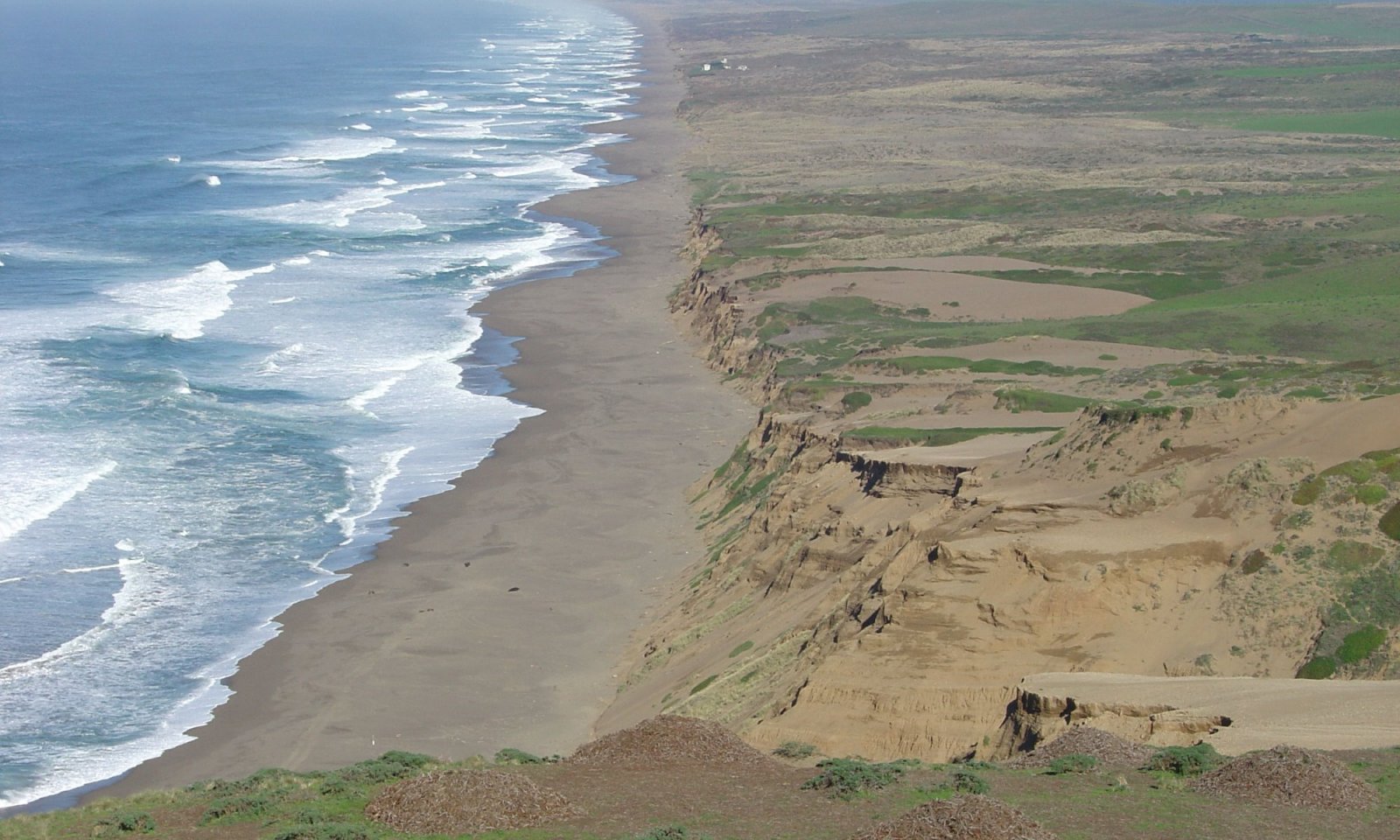
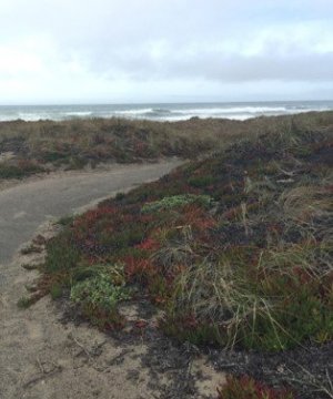
Windy coastal beaches and dunelands


Scenario model
Current ecosystem state
Select a state

Management practices/drivers
Select a transition or restoration pathway
- Transition T1 More details
- Transition T3 More details
- Restoration pathway R1 More details
- Transition T2 More details
- Restoration pathway R2 More details
-
No transition or restoration pathway between the selected states has been described
Target ecosystem state
Select a state
Description
The dynamics described below are general to the level that the site concept has been developed for provisional ecological site concept identification and further investigation purposes only. It is meant to give a general overview of the ecological dynamics of the system and should not be viewed as a model for a specific ecological site level management. It is supported by the current available literature that was reviewed for a general understanding of the system and basic understanding of the abiotic and biotic drivers. Further investigations and soil-site data collection and analysis should be conducted before specific land management can be applied at the ecological site specific scale. This STM only serves to explain the general ecology and dynamics.
Reference State (State 1) – This reference state includes a patchwork of coastal scrub dominated shrublands and coastal prairie dominated grasslands. These communities are all varied in size and extent, depending on the width of coastline available, elevation and slope, the geologic and soil substrates, and dynamics of disturbance. This variability requires further site investigation and field data collection to refine these communities to the appropriate ecological site scale for more specific site characteristics for each of these finer-scaled differences that have impacts on the land management decision-making process. The coastal prairie is less dominant in this ecological site due to the infrequent fires, and reduction in grazing activities that would have assisted in keeping the coastal scrub species from encroaching into the prairies and dominating the overstory structure. Much of this ecological site is now coastal scrub and dominated primarily by coyotebrush.
Submodel
Description
This state represents the community phases that have been invaded by non-native species. This ecological site is highly susceptible to non-natives and invasives, given the current types of pressures from fire removal and human use in this LRU. Non-natives and invasives are able to capitalize quickly on available resources much better than the native species can, especially during years that are hotter and drier than average. This state currently represents all the different types of communities found in this coastal strand and coastal plains and terraces portion of LRU M. In the future more information and research should be done to determine more specific dynamics in this state that are more heavily related to the different community expressions within this state and the dynamics amongst them all.
Submodel
Description
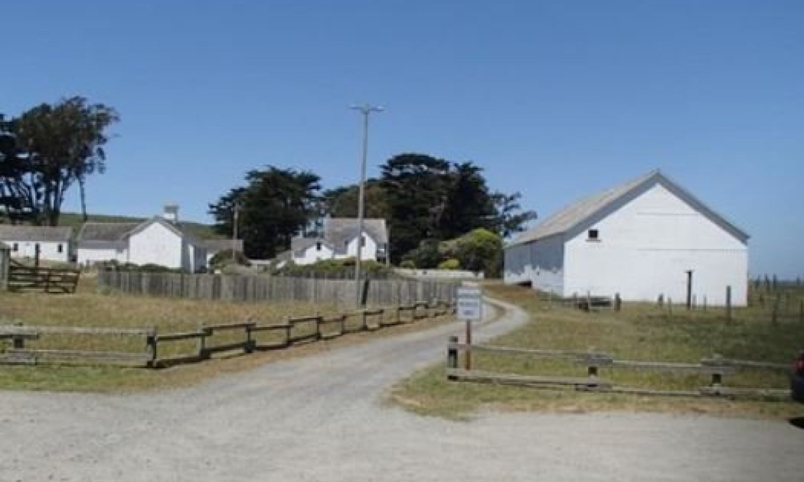
This state represents the intensive land uses that have significantly altered this ESG in a myriad of ways including removal of topsoil, fertilizer additions and other topsoil manipulations, hydrologic alterations that remove native soil fauna, among many other things and is typically due to urban developments, recreational activities, and intensive agriculture. More information about this state is needed to flesh out the various impacts these types of land uses/alterations have had on the ecological site in order to better understand how to manage these areas or potentially attempt restoration of these areas where possible.
Submodel
Mechanism
This transition occurs when the seed source is introduced to the ecological site. At Point Reyes, non-native plants were introduced to provide soil stabilization in this duneland ecosystem in order to reduce the movement of the dunes that impacted the ranching and dairy farms and settlements.
This ESG limited resistance to outside pressures like invasive species, and in Community Phase 1.2 the site is most at-risk of this type of invasion. The threshold is crossed when feedback mechanisms shift from natural dynamics to feedback mechanisms that cater to the invasive species.
Mechanism
This transition is caused by significant human alterations that remove essential topsoil horizons, alter hydrologic functions, and/or add significant inputs that change soil chemistry and soil properties for housing developments, urban infrastructures or intensive cropping systems and force this ecological site over a threshold and change the function and structure of this site in extensive ways.
Mechanism
Restoring ecological processes to the coastal dunelands in Point Reyes National Seashore is a complex task, due to the combination of stressors and the economic and social interests related to this park and these dunelands.
Removing the European beachgrass, searocket and iceplant would increase the instability of dunes slopes and basins and change system topography, with the degree of change dependent upon the restoration approach that is used. Destabilizing the dunes would ideally provide the release from the root stabilization of these non-native plants, however it could further damage what may remain of sensitive or limited populations of the native dune plants as well (NPS, 2015). Given the nature of the duneland environment, without immediate recovery of the native vegetation, either through plantings or natural re-seeding, the extremely successful non-native species will return in short order (McGraw et al., 2017).
Manual removal is the preferred method of removal for European beachgrass and has been found to reduce competition with the native species when there are intact stands of native species in proximity of the treated areas. However, if European searocket or iceplant are also in the mix of species, additional strategies will be necessary to avoid a transition to a monotypic stand of one of these species instead (Buell et al., 1995). Another consideration to management of invasives in these dunelands, is that European searocket is able to maximize the nitrogen made available by native and non-native nitrogen-fixers common in these dunelands making them larger and more resistant and resilient to disturbance or stress. Targeting areas with limited nitrogen-fixers or undesirable nitrogen-fixers (non-native bush lupines) may be easier to treat than those with a mix of native dune lupines, including the endangered Tidestorm’s lupine (McGraw et al., 2017 and NPS, 2015).
Restoration would encourage more natural dune processes that would result in more natural dune topography, providing vital habitat for endemic plants and animals that is also more resilient to potential future disturbances such as sea level rise, increased wave scour and storm surge, and, potentially, stronger coastal winds, all of which might necessitate migration of dunes systems inland if they are to persist in the future (NPS, 2015).
Context dependence
The very nature of this ESG makes it difficult to tackle restoration, since the primary ecological disturbance, wind-blown sand deposition and destabilization, creates a complex patchwork of active blowing dune sands all the way to semi-stabilized dunes. Restoring this dynamic may include deposition in associated areas where sediment deposition is undesirable. These associated areas are coastal grasslands and coastal scrub areas that provide wildlife habitat and forage for the still active dairy and beef operations still present within the boundaries of the National Seashore.
Impacts such as these are generally avoided or minimized through implementation of several mitigation measures, including tapering slopes, limiting restoration activities near the livestock operations when possible, and conducting active revegetation (plug plantings, etc.) of back dune areas that are more inland and will have greater impacts to the associated sites (NPS, 2015).
Mechanism
This transition is caused by significant human alterations that remove essential topsoil horizons, alter hydrologic functions, and/or add significant inputs that change soil chemistry and soil properties for housing developments, urban infrastructures or intensive cropping systems and force this ecological site over a threshold and change the function and structure of this site in extensive ways.
Mechanism
This restoration pathway occurs only when significant time and money inputs are focused on areas that have not been permanently altered by urban developments. This restoration pathway may be more likely than R1, since most of these very altered landscapes will be more hospitable to invasive species than to the native species that are more particular and require specific growing conditions that may not be replicable due to the alterations to the site that had occurred.
Model keys
Briefcase
Add ecological site groups and Major Land Resource Areas to your briefcase by clicking on the briefcase (![]() ) icon wherever it occurs. Drag and drop items to reorder. Cookies are used to store briefcase items between browsing sessions. Because of this, the number of items that can be added to your briefcase is limited, and briefcase items added on one device and browser cannot be accessed from another device or browser. Users who do not wish to place cookies on their devices should not use the briefcase tool. Briefcase cookies serve no other purpose than described here and are deleted whenever browsing history is cleared.
) icon wherever it occurs. Drag and drop items to reorder. Cookies are used to store briefcase items between browsing sessions. Because of this, the number of items that can be added to your briefcase is limited, and briefcase items added on one device and browser cannot be accessed from another device or browser. Users who do not wish to place cookies on their devices should not use the briefcase tool. Briefcase cookies serve no other purpose than described here and are deleted whenever browsing history is cleared.
Ecological site groups
Major Land Resource Areas
The Ecosystem Dynamics Interpretive Tool is an information system framework developed by the USDA-ARS Jornada Experimental Range, USDA Natural Resources Conservation Service, and New Mexico State University.