Ecological site group P220X100(18570)
Lowlands Northern Extent
Last updated: 03/13/2025
Accessed: 05/10/2025
Ecological site group description
Key Characteristics
None specified
Provisional. A provisional ecological site description has undergone quality control and quality assurance review. It contains a working state and transition model and enough information to identify the ecological site.
Physiography
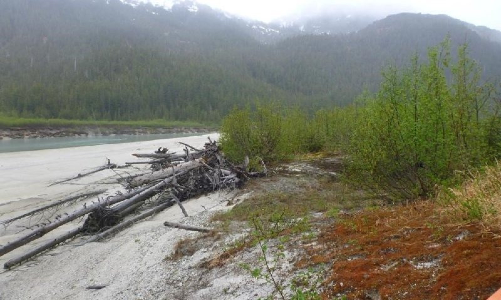
The Lowland Grouping occurs from the high floodplains occurring above the river valleys down to the coastal plains. The grouping is associated with river and stream channels. These flood plains are rarely to frequently flooded, and may include some closed depressions where water ponds on the surface for long durations. The water table is usually more than 72 inches below the soil surface, but can rise to within 18 inches of the surface during wet periods. In ponded depressions, the water table is at or above the soil surface for long periods. Slopes range from 0-15% with elevations as high as 1850 feet.
Runoff Class - Low to Medium
Flooding Duration - Very brief (4 to 48 hrs) to Brief (2 to 7 days)
Flooding Frequency - Very Rare to Frequent
Ponding Duration - Long (7 to 30 days)
Ponding Frequency - None to Frequent
Elevation - 0 to 450 ft (modal)
Slope - 0-15%
Water Table Depth - Greater than 18 inches
Aspect is not a factor.
The hydrology of this site is characterized by rare to frequent freshwater flooding during spring runoff and other large storm events. In the event that high-intensity flooding removes vegetation on this site, which occurs less frequently than on the adjacent low flood plain site, the result is several years to decades of alder and willow cover followed by a gradual increase in tree cover. Closed depressions on the flood plain are frequently ponded for long durations.
Climate
The climate varies widely across this MLRA. Climate summaries are currently limited and not representative for this Ecological Site. Further investigation is in process.
Soil features
The soils of this site formed in deep alluvial deposits on high flood plains by freshwater rivers and streams. Soil textures are stratified silt loams to loamy sands, often with lenses of gravel and sandier textures in deeper soil horizons. A thin organic layer is common on the soil surface. Relatively small, closed depressions occur on these high flood plains, and often have very deep peat deposits as a result of long duration ponding. These soils are typically moderately well- and well-drained, with very poor drainage in closed depressions. The soil moisture regime of this site is udic or oxyaquic udic except in depressions, which are aquic.
Parent Material - Alluvium and Organic material
Surface Textures - Gravelly sand to Silt loam (Loamy sand, Sandy Loam) and peat
Drainage Class - Moderately well to well drained
Permeability Class - Moderately rapid to Rapid
Soil Depth - Very deep (greater than 60 inches)
AWC (0 to 10 inches in depth) - 0.2 to 2.7
AWC (10 to 40 inches in depth - 0.5 - 8.3
pH - 4.5 to 7.3
Subsurface Fragments - 0 to 70%, generally small to coarse gravels, few cobbles and stones.
Vegetation dynamics
This site is associated with flood plains of large rivers and tributaries along the Gulf of Alaska. Until about 10,000 years ago, this area had many continental-scale ice sheets that advanced and retreated many times over millennia (Chapin 1994). The final advance of these glaciers occurred during the Little Ice Age, which peaked about 1750 AD. Since then, many glaciers have thinned and retreated inland, while numerous tidewater glaciers still exist in the area (Lawson 2015). The 250-year glacial retreat is attributed to less regional snowfall in the mountains, rising winter temperatures, and decreased cloud cover and lower precipitation during the growing season in summer (Hall et al. 2003).
During the past 250 years of glacial retreat, meltwater transported and deposited a large amount of silt and sediment via numerous short, high-gradient rivers. Alluvial and colluvial fans and long foot slopes are common in the valleys along the base of the mountains. The flood plain catena generally occurs across broad and braided channels with a high gradient, and feed into the tidally influenced estuarine areas.
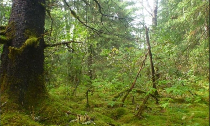
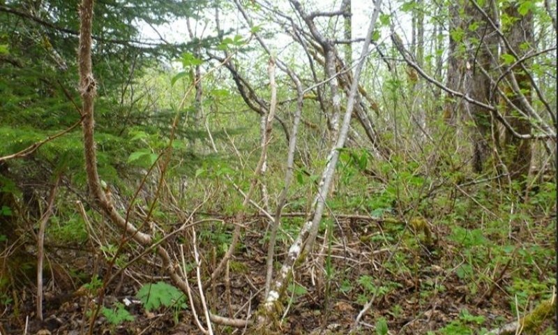
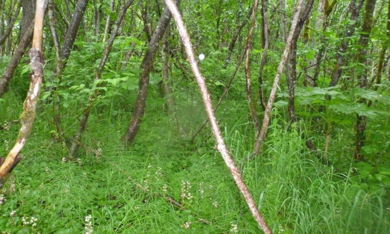
This site supports a reference state composed of three community phases that reflect a disturbance regime of flooding intensity. A tall shrub community with abundant herbaceous understory plants is typical following severe flood events. In the absence of severe flooding, the abundance of balsam poplar trees increases, and the community resembles an open forest. If flooding becomes even less frequent, Sitka spruce becomes dominant, and understory shrubs and forbs are largely displaced by moss species.
Browsing by moose on willow species was observed on this ecological site, but it does not appear to affect the ecological processes enough to alter the communities.
Chapin 1994: https://www.researchgate.net/publication/216810560_Mechanisms_of_Primary_Succession_Following_Deglaciation_at_Glacier_Bay_Alaska
Lawson 2015:
https://www.researchgate.net/publication/276471458_Glaciological_and_marine_geological_controls_on_terminus_dynamics_of_Hubbard_Glacier_southeast_Alaska
Hall et al 2003:
053[0131:mcigci]2.0.co;2
Major Land Resource Area
MLRA 220X
Alexander Archipelago-Gulf of Alaska Coast
Subclasses
- R220XY362AK–Subalpine Sedge Wet Flood Plain
- R220XY426AK–Maritime Shrub Low Flood Plain
- R220XY434AK–Maritime Scrubland Peat Plain Depression
- R220XY436AK–Maritime Graminoid Loamy Wet Plain
- F220XY325AK–Maritime Forest Gravelly Floodplains, High Gradient Occasionally Flooded
- F220XY333AK–Maritime Forest Gravelly Floodplains, Occasionally Flooded
- F220XY334AK–Maritime Forest Gravelly Floodplain, Rarely Flooded
- F220XY427AK–Maritime Forest Gravelly High Floodplain
- F220XY440AK–Maritime Forest Loamy Plains
- F220XY460AK–Maritime Forest Gravelly Alluvial Plains
- F220XY466AK–Maritime Forest Sandy Plains Eolian
- R220XY306AK–Maritime River Wash, Bouldery
- R220XY307AK–Maritime Gravelly Floodplains
- R220XY324AK–Maritime Scrub Gravelly Floodplain, Mountain Confined
- R220XY328AK–Maritime Scrub/ Herb Mosaic Organic Floodplain
- R220XY330AK–Estuarine Graminoid Loamy Floodplain, Depression
- R220XY331AK–Maritime Scrub Gravelly Floodplain, Depression
- R220XY332AK–Maritime Scrub Gravelly Floodplains, Frequently Flooded
- R220XY361AK–Subalpine Shrub Dry Flood Plain
Correlated Map Unit Components
25074010, 25074011, 25074013, 25074014
Stage
Provisional
Contributors
Tyler Annetts
Phil Barber
Blaine Spellman
Marji Patz

Click on box and path labels to scroll to the respective text.
Ecosystem states
State 1 submodel, plant communities
| 1.1a | - | High-intensity flood events remove vegetation |
|---|---|---|
| 1.2a | - | Lack of high-intensity flood events leading to secondary succession. |
| 1.2b | - | High-intensity flood events remove vegetation |
| 1.3a | - | Lack of high-intensity flood events leading to secondary succession. |